

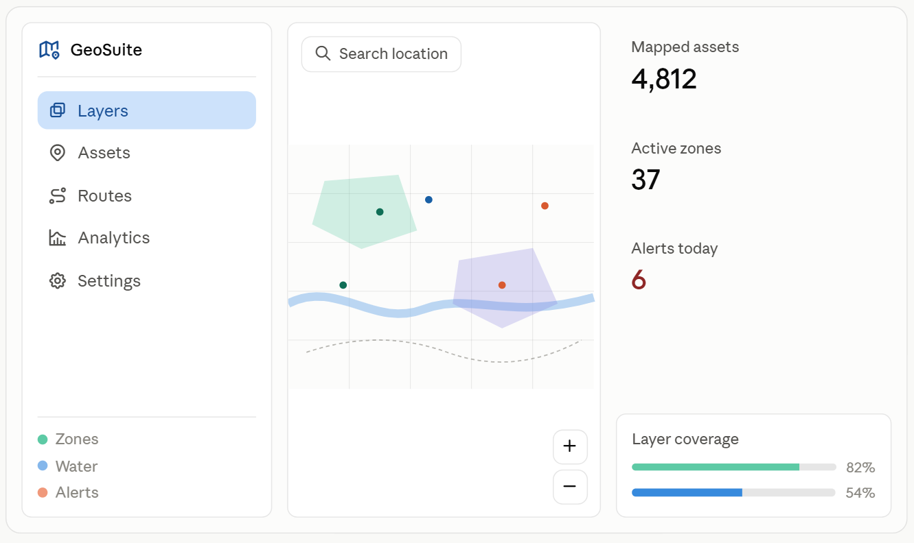
Every business decision has a location tied to it. A delivery truck sits on a road. A flooded field sits on a plot of land. A new store needs a neighborhood. GIS software turns that location data into something a team can act on, instead of a fact buried in a spreadsheet.
This guide covers what GIS software development means, the tools behind it, the industries that depend on it, and what a business needs to know before starting a project. Real market data backs up each claim, with sources noted throughout.
What is a GIS Software Development?
GIS stands for Geographic Information System. GIS software collects, stores, and displays data tied to a place on a map. GIS software development is the process of building these tools for a specific business, instead of buying a one-size-fits-all mapping app.
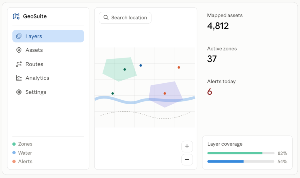
A regular map app shows a location as a pin. GIS software connects that pin to other data points, like sales figures, soil quality, flood risk, or delivery time. A logistics company can see which routes waste fuel. A city planner can see which neighborhoods flood most often. A farmer can see which fields need more water. The map becomes a decision tool rather than just a picture.
Custom GIS software differs from off-the-shelf platforms like Google Maps because it is built around one organization’s own data and workflow. The database, the map layers, and the dashboards all reflect what that specific team needs to track.
A Short History of GIS Software
GIS software started as a government and research tool in the 1960s, built to manage land records and environmental data. Early systems ran on mainframe computers and needed trained specialists to operate.
Desktop GIS software became common in the 1980s and 1990s, with tools like ArcGIS giving planners and surveyors a way to build maps on personal computers. The 2000s brought web-based mapping, letting anyone view spatial data through a browser.
The past ten years shifted the field again. Cloud hosting, mobile data collection, and open source tools like QGIS and PostGIS opened GIS development to smaller teams and custom software builders, not just large agencies with big budgets. This shift explains why more mid-size businesses now build their own GIS platforms instead of licensing a fixed product.
The GIS Software Market by the Numbers
Location data use keeps growing across industries. Market research backs this up.
| Global GIS software market size | $12.7 billion | 2026 |
| Projected market size | $43.4 billion | 2035 |
| Annual growth rate (CAGR) | 14.6% | 2026-2035 |
| ArcGIS installed user base | 350,000+ organizations in 200+ countries | Current |
The global geographic information system market stood at 11.6 billion dollars in 2025 and is set to grow at a 14.6 percent yearly rate through 2035, driven by rising demand for location-based intelligence across industries. By 2035, the market is projected to reach $ 43.4 billion, up from $ 12.7 billion in 2026.
Esri holds the largest share of this market, backed by a strong position in US federal and state government GIS work and a global ArcGIS user base spanning more than 350,000 organizations in over 200 countries. That number alone shows how much of daily government and business operations already run on GIS platforms.
Government use stands out as a major growth driver. More than 32 percent of government-led infrastructure projects now use GIS tools for city planning, utility mapping, and environmental monitoring. Close to 28 percent of global spending on digital urbanization depends on spatial analysis for transportation management and sustainable development planning.
In the United States, the Geological Survey, the Federal Emergency Management Agency, and the Department of Defense rank among the largest institutional buyers of GIS software, giving vendors a ste-ady and recurring base of demand.
Types of GIS Software
A business planning a GIS project has four main deployment options. Each fits a different use case.
| Desktop GIS | Installed on one computer, runs without a constant internet connection | Detailed spatial analysis, survey work |
| Web GIS | Accessed through a browser, hosted on a server | Teams that need shared access from different locations |
| Cloud GIS | Hosted and scaled by a cloud provider, billed by subscription | Growing platforms that need to add users or data fast |
| Mobile GIS | Runs on phones or tablets, often with offline data capture | Field teams collecting data on site |
Cloud GIS has picked up the fastest pace of adoption in recent years. More than 72 percent of new GIS implementations were cloud-native in 2025, compared with 49 percent in 2020, marking a sharp shift away from desktop-only systems. Cloud-based GIS deployment is projected to grow at a 13.1 percent yearly rate between 2026 and 2034, outpacing the 9.2 percent growth rate of the overall GIS software market.
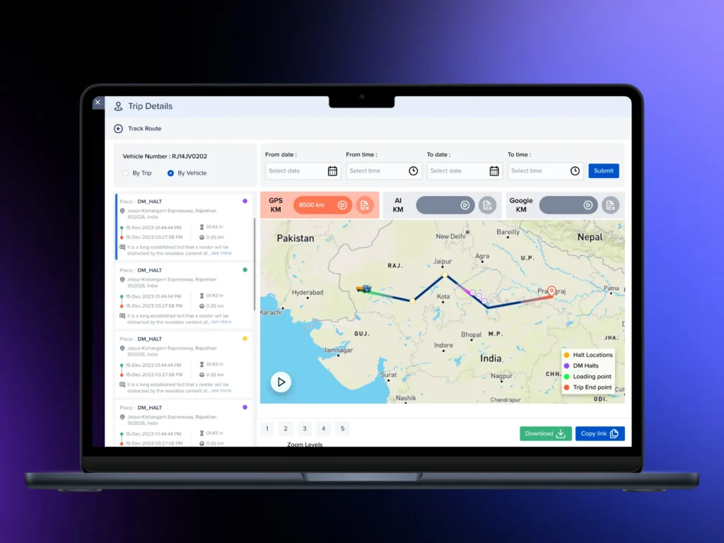
Utility companies show this shift clearly. More than 59 percent of utility operators now use cloud GIS to track field assets and maintenance schedules. A cloud setup lets a maintenance crew update asset status from a job site, with changes visible to the office within seconds.
Most custom GIS platforms today combine more than one type. A common setup pairs a cloud-hosted database and web dashboard for the office team with a mobile app for field staff, so both sides work off the same live data.
Industries Running on GIS Software
GIS software is not limited to mapping companies or government agencies. It supports daily operations across many sectors.
| Government and public administration | Land registration, zoning, disaster response, asset mapping |
| Utilities and energy | Pipeline and grid mapping, outage tracking |
| Logistics and supply chain | Route planning, fleet tracking, delivery time estimates |
| Agriculture and forestry | Soil analysis, crop monitoring, irrigation planning |
| Insurance and financial services | Risk mapping, property assessment, flood zone checks |
| Construction and real estate | Site selection, land surveys, permit tracking |
| Environment and natural resources | Habitat tracking, pollution monitoring, land use change |
| Retail | Store site selection, market coverage analysis |
Government use leads other sectors in scale. GIS platforms support governments as they monitor environmental changes and help emergency services plan disaster responses. A single land registration system can serve millions of property records tied to exact map coordinates, something a spreadsheet cannot handle at that scale.
Utilities depend on GIS for a different reason: physical infrastructure sits underground or across wide areas, and a visual map is often the only practical way to track it. A gas company can pull up a pipeline map instantly instead of digging through paper records during an emergency repair.
Agriculture has grown into one of the faster-moving segments, since GIS software paired with satellite imagery lets a farm track soil moisture and crop health across thousands of acres without walking every field by hand.
Core Components of GIS Software
A working GIS platform is built from four core parts. Each one plays a specific role.
Spatial database. This stores the location data along with related information, like a customer address linked to order history. PostGIS, an extension of PostgreSQL, is a common open source choice for custom builds. It lets a database run spatial queries, like finding every customer within five miles of a warehouse.
Map rendering engine. This draws the actual map inside a browser or app. Leaflet, Mapbox GL, and OpenLayers are widely used tools for this layer. They handle zoom levels, map tiles, and how data points appear on screen.
Analysis tools. These process the data to find patterns. QGIS, an open-source desktop tool, along with Python libraries like GeoPandas and Shapely, handle spatial math such as distance, buffer zones, and overlap between areas. GDAL, a data conversion library, handles raster data like satellite images.
APIs and integration layer. This connects the GIS platform to other business systems. REST and GraphQL APIs let a GIS platform pull data from a CRM, inventory system, or third-party service, so the map reflects live business data instead of a static export.
These four parts work together. A field team logs a broken pipe location through a mobile app. The spatial database stores the coordinates. The analysis tools flag which properties sit downstream and might lose water pressure. The map rendering engine shows the affected zone to the dispatch team in real time.
Features That Matter in GIS Software
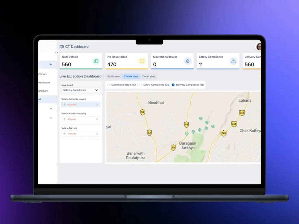
A business evaluating a GIS project should look for six features in particular.
1. Real-time tracking. Live GPS data on vehicles, assets, or field staff, updated through GPS feeds and protocols like MQTT, so the map reflects current positions instead of yesterday’s data.
2. Spatial data analysis. Tools that turn raw coordinates into distance, density, and pattern reports, letting a team spot trends instead of reading a list of numbers.
3. Custom dashboards. Reports built around the metrics a team checks daily, with filters for date range, region, or asset type, instead of a fixed report nobody customizes.
4. Data integration. Connections to existing databases and third-party tools through APIs, so field data, sales data, and location data live in one system.
5. Offline support. Field teams often work without a signal. A strong GIS mobile app caches data locally and syncs once the connection returns.
6. Scalable infrastructure. A platform built to handle 500 users should not break at 50,000. Containerized infrastructure and cloud hosting let a system grow without a full rebuild.
Benefits of GIS Software for a Business
A custom GIS platform pays off in a few concrete ways.
Faster decisions. A dispatcher who sees live vehicle positions on a map reroutes a driver in seconds, instead of calling around to find out who is closest.
Lower operating costs. Route optimization alone can cut fuel use and driver hours for a delivery fleet. Utility companies save repair time when a crew can pull up exact pipeline depth and material instead of guessing.
Better risk management. Insurance and financial firms use flood zone and property risk maps to price policies more accurately, instead of relying on broad, outdated zone codes.
Stronger compliance. Government agencies use GIS records to track zoning, permits, and land use changes, which supports audits and legal reviews.
Clearer reporting. A dashboard built on spatial data turns a pile of location logs into a chart a manager can read in one glance.
The GIS Software Development Process
Building GIS software follows a set process, similar to other custom software projects, but with extra steps for spatial data handling.
| 1. Requirement gathering | Define the data sources, target users, and the core problem the software should solve |
| 2. Data collection and structuring | Gather spatial data from existing records, GPS devices, or satellite sources, then clean and standardize it |
| 3. Architecture planning | Choose the database, map rendering engine, hosting setup, and integration points |
| 4. Development and testing | Build the platform in stages, testing with real location data at each step |
| 5. Deployment | Launch the platform, connect it to live systems, and train the team |
| 6. Support and maintenance | Fix bugs, patch security issues, and add features as the business grows |
Data structuring often takes longer than expected on a GIS project. Location data comes in formats like Shapefiles, GeoJSON, or KML and often needs cleanup before it works inside a new system. A project timeline should account for this step, not treat it as an afterthought.
Testing also carries extra weight in GIS software. A bug in a normal app might show the wrong number on a screen. A bug in a GIS platform might place a delivery truck on the wrong street or a flood zone in the wrong location, so testing against real coordinates matters more here than in most software projects.
Common Challenges in GIS Software Development
Spatial data brings problems a standard software project does not face.
Large data volumes. Satellite imagery, GPS logs, and sensor feeds pile up fast. A single high-resolution satellite image can reach gigabytes in size. The database and storage plan need to handle this load without slowing the platform down.
Data accuracy. Bad coordinates, outdated boundaries, or mismatched map projections lead to poor decisions downstream. Regular data checks and validation rules catch these errors before they reach a live dashboard.
System growth. A platform built for a pilot group of 50 users can struggle with 5,000. Planning for growth from the start, through containerized services and scalable databases, avoids a costly rebuild later.
Legacy system connections. Many businesses run older databases or desktop-only GIS tools that do not connect easily to modern cloud platforms. Migration work, including format conversion and data validation, requires real planning time.
Workforce skill gaps. A lack of skilled GIS workers ranks among the common barriers reported across the industry, alongside integration and interoperability issues between different systems. This makes the choice of a development partner with real GIS experience more important than for a typical software project.
Data Security in GIS Software
Location data counts as sensitive information in many cases, especially for government agencies, utilities, and defense-related work. A GIS platform needs its own security plan, not a generic one borrowed from a standard web app.
Around 44 percent of organizations point to concerns over exposing sensitive location data as a top worry with cloud GIS, while 39 percent report limits tied to data residency rules that require certain data to stay within a specific country or region.
A strong GIS security setup includes:
- Encrypted data storage and transfer, so location records stay protected both at rest and in motion
- Role-based access controls, so a field worker sees only the data tied to their assigned area
- Audit logs that track who viewed or changed a record
- Private hosting options for government or defense clients that cannot use public cloud infrastructure
Government departments managing land ownership records, defense zones, or citizen data often require a private or hybrid hosting setup instead of a fully public cloud platform, due to these residency and security rules.
GIS Software Trends: AI, IoT, and Cloud
Three trends are shaping GIS software development right now.
Artificial intelligence. Close to 57 percent of GIS buyers now ask for automated feature detection, predictive routing, and land use classification built directly into the platform. AI tools can scan satellite imagery and flag changes, like new construction or deforestation, without a person reviewing every image by hand.
Internet of Things. Sensors on vehicles, utility equipment, and farm machinery feed live data straight into GIS platforms. A water utility can track pressure sensors across an entire pipeline network on a live map, instead of waiting for a manual inspection report.
Cloud-first deployment. As covered earlier, cloud-native GIS platforms have overtaken desktop-only systems in new projects. Government and public sector use is expected to hold the largest share of the cloud GIS market, while utilities and energy make up one of the fastest-growing segments. This shift means most new GIS software gets built cloud-first from day one, rather than adapted from an older desktop system later.
These three trends point in the same direction: GIS software is moving from a static mapping tool toward a live, connected system that updates and reacts on its own.
Choosing a GIS Software Development Partner
A few checks help separate a strong development partner from a weak one.
- GIS-specific tool experience. Ask about direct experience with PostGIS, ArcGIS, QGIS, or similar tools, not just general web development background.
- A track record of live deployments. A finished demo is not the same as software running under real daily use with real data.
- In-house design and development. A team that handles both design and backend work together tends to catch problems earlier than a project split across outsourced groups.
- A clear support plan. Ask what happens after launch. Bug fixes, security patches, and feature updates should be part of the agreement, not a surprise cost later.
- Data migration experience. If the project involves moving data from an old system, ask for specific examples of past migrations, including how they checked for data loss.
Cost Factors in GIS Software Development
GIS software costs vary widely based on a few clear factors.
| Feature scope | Real-time tracking and AI-based analysis cost more than a static map |
| Data volume | Large datasets, like satellite imagery, need stronger storage and processing infrastructure |
| Build type | A fully custom platform costs more upfront than extending an existing tool like ArcGIS or QGIS |
| Integration needs | Connecting to many existing systems adds development time and testing |
| Security requirements | Private hosting and strict access controls add setup cost, especially for government projects |
A basic mapping tool, built on existing libraries with limited custom features, can launch in a few weeks. A full platform with live tracking, AI-based analysis, and multiple system integrations usually takes two to four months, sometimes longer for large government or enterprise projects with strict security review steps.
Ongoing hosting and maintenance costs also matter. Cloud-hosted platforms carry a recurring subscription cost tied to data volume and user count, while an on-premises system carries a higher upfront hardware cost with lower recurring fees.
Final Takeaways
GIS software turns raw location data into a tool a business can act on daily. Government agencies already run large parts of their operations on it, and the wider market is projected to grow at 14.6 percent a year through 2035. Utilities, logistics companies, farms, and insurers are following the same path, moving from static maps toward live, connected platforms built on cloud infrastructure and, increasingly, AI-based analysis.
A business planning its own GIS platform should start with a clear picture of its data, choose tools suited to spatial work rather than generic software, and pick a development partner with real experience deploying GIS platforms under live conditions, not just in a demo. Getting these choices right early avoids a costly rebuild once the platform is live and in daily use.