GIS Software Development Services
Our Services View

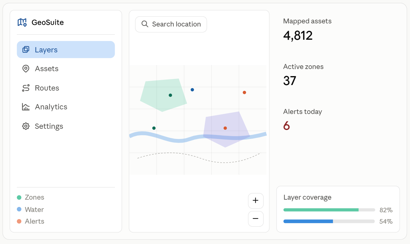
Noun Design builds GIS software that turns raw location data into clear, usable insights. From custom map applications to spatial analysis tools, our team manages the entire development process. Your business receives software that fits your exact workflow, not a generic template. Our team creates GIS platforms that help map, track, and analyze large amounts of spatial data. We work with many industries, like logistics and urban planning, and build tools that make it easy to use complex location data.

gis software development services

/ Features

We design and develop GIS software your team can actually use. Think custom maps, spatial analysis, live tracking, and clean dashboards. Built on scalable, cloud-ready architecture, shaped around your workflow, not a generic template.

01.

Custom Map Applications

We build custom map apps using Leaflet, Mapbox GL, and OpenLayers, backed by PostGIS and PostgreSQL. Every layer, from vector tiles to raster overlays, is tailored to your data and zoom levels, not a plug-and-play template.

02.

Spatial Data Analysis

We run spatial analysis with PostGIS, QGIS, and Python (GeoPandas, Shapely) to process distance, buffer, and terrain data. Raw coordinates become heatmaps, clusters, and routing insights your team can use.

03.

Real-Time Location Tracking

Track vehicles, assets, or field teams using GPS feeds, WebSockets, and MQTT for live updates. Positions render on Mapbox or Leaflet in real time, with geofencing alerts built on PostGIS spatial queries.

04.

Data Integration and Migration

We connect your GIS software to ArcGIS, GeoServer, and legacy SQL databases through REST and GraphQL APIs. Shapefiles, KML, and GeoJSON get migrated and validated, so nothing breaks during the switch.


05.

Scalable System Architecture

Built on PostgreSQL, PostGIS, and containerized microservices (Docker, Kubernetes), our GIS platforms handle rising data volumes and users without a rebuild. Tile caching and CDN delivery keep maps fast at scale.

06.

Custom Dashboards and Reporting

We build dashboards with React, D3.js, and Mapbox GL, pulling live queries from PostGIS. Track coverage, density, and activity trends with custom filters, not a fixed template you can’t edit.

/ Why Us

Noun Design builds GIS software that goes from idea to deployment. One of our MVP builds now runs in an active government project, not a pitch deck. We design, build, and ship all in-house.

Proven in a Live Government Project

One of our MVP builds is now live in a government project, handling real spatial data at scale. It proves our software works outside a demo, under real usage and reporting requirements.

Full-Cycle Development

We handle the full build, from wireframes and system design to deployment and handover. You work with one team throughout, not a chain of freelancers or outsourced parts.

In-House Design and Engineering

Design and development sit under one roof. Your GIS software gets a clean interface and solid backend logic together, built by teams that talk to each other daily.

Built to Scale

We build on PostGIS, PostgreSQL, and containerized infrastructure, so your platform handles more users and data later without a full rebuild.

Fast MVP to Product Turnaround

We move from MVP to a working, testable product fast, usually in weeks, so you can validate with real users before committing to a full build.

Support After Launch

Launch is not the end. We provide ongoing maintenance, bug fixes, and feature updates, so your GIS software keeps working as your data and team grow.

/ Portfolio

Featured Projects

Take a look at our portfolio to see how we’ve helped businesses across various industries transform their digital presence. Each project is a testament to our commitment to creativity, quality, and innovation.

Load More

/ Review

The design was exactly what I asked for. Very good communication with the team, response time was efficient. True professionals in their craft.

Tiffany Mosinski — Planned Elegance Weddings United States · 5★ on Trustpilot

/ Review

Genuinely one of the best experiences. Consistent quality, clear communication, no surprises. 5-star all around.

Rachel V. — MediScoot Australia · 5★ on Clutch

/ Review

Jibon and Masum are a wonderful team. Always available for urgent tasks — made fantastic bones for the structure of my website. Highly recommend!

Amita — Kreem Shakti Hong Kong · 5★ on Trustpilot

/ Review

I couldn't have imagined a better web designer for the job. Always reachable. Changes and requests implemented immediately. Very satisfied — will continue working together in the future.

mia_berlin — The Kitesurf Academy Germany · 5★ on Fiverr

/ Review

I'm so happy I found this company. They are very professional and really care about your project — and it shows. You won't regret trusting them with your work.

Khalid — Camiru United States · 5★ on Trustpilot

Questions and answers

Everything you need to know about the product and billing.

Got Questions? We've Got Answers!

We believe that clarity is key. Whether you’re curious about our services, need assistance, or just want to know more, we’re here to help!

  • How it works – Get clear and simple explanations.
  • Need support? – Reach out, and we’ll respond quickly.
  • Looking for details? – Browse through our FAQs for instant answers.
1. What is GIS software development?
GIS software development means building tools that collect, store, and analyze location-based data. This includes custom maps, spatial databases, and analysis tools for a specific business need.
2. How long does a GIS software project take?
Timelines depend on scope. A basic mapping tool can take a few weeks. A full platform with data integration and analytics usually takes two to four months based on complexity.
3. Do you build GIS software from scratch or use existing platforms?
Both options work depending on the project. We build fully custom platforms using PostGIS and PostgreSQL or extend existing tools like ArcGIS and QGIS when that better fits the budget and timeline.
4. Can you integrate GIS software with our existing systems?
Yes. We connect GIS platforms to your existing databases, sensors, or third-party tools through REST and GraphQL APIs. Data formats like Shapefiles, KML, and GeoJSON migrate without loss of accuracy.
5. What industries use GIS software?
Logistics, real estate, agriculture, urban planning, and government agencies use GIS software most often. Any business that tracks locations, assets, or spatial patterns can benefit from it.
6. Is our data secure with your GIS software?
Data security is built into every layer, from database access controls to encrypted API connections. Sensitive location data remains protected during storage, transfer, and use.
7. Can GIS software scale as our data grows?
Yes. Our platforms run on scalable infrastructure, including containerized services and cloud-ready databases, so adding data or users does not require a full rebuild.
8. Do you provide support after the GIS software is launched?
Yes. We handle bug fixes, feature updates, and ongoing maintenance after launch so the software keeps working as your data and team grow.
9. What makes your GIS software development different from competitors?
Our team handles design and development together in-house from planning to deployment. One of our MVP builds is already running inside a live government project, proving the software holds up under real conditions.
10. How much does GIS software development cost?
Cost depends on scope, data volume, and features needed. A basic mapping tool costs less than a full platform with real-time tracking and analytics. We provide a detailed quote after we understand your requirements.
11. What is the difference between GIS and a regular mapping app?
A regular mapping app just shows locations. GIS software stores, analyzes, and connects spatial data with other business data so you get insights, not just a pin on a map.
12. Can you build GIS software for mobile and web at the same time?
Yes. We build GIS platforms with a shared backend using React and React Native or Flutter, so your team gets the same data and features on both web and mobile.
13. Do you offer real-time tracking as part of your GIS software?
Yes. We build live tracking using GPS feeds, WebSockets, and MQTT so vehicles, assets, or field teams update on the map as they move, not on a delay.
14. What file formats does your GIS software support?
We work with Shapefiles, GeoJSON, KML, and CSV data along with raster formats for satellite and aerial imagery. Data comes in different formats and is standardized during setup.p.
15. Can your GIS software handle satellite or drone imagery?
Yes. We process raster data from satellite and drone sources using GDAL and QGIS, then layer it into your GIS platform for analysis alongside your other spatial data.
16. Do you build custom dashboards for GIS data?
Yes. We build dashboards with React and Mapbox GL pulling live data from PostGIS. You get filters, charts, and reports built around the metrics your team actually tracks.
17. Can GIS software work without internet access in the field?
Yes, with offline support. We build caching and local storage into mobile GIS apps so field teams can collect and view data without a live connection, then sync once back online.
18. Do you sign an NDA before starting a GIS software project?
Yes. We sign NDAs before any project discussion involving sensitive data or business details, including projects with government or enterprise clients.
19. Can you migrate our old GIS system to a new platform?
Yes. We handle migration from legacy systems, including old ArcGIS setups or custom databases, moving your data to PostGIS or a modern stack without data loss.
20. Who owns the GIS software after development is complete?
You do. Once the project is delivered and paid for, full ownership of the code, data, and system goes to your business. We do not retain rights to the final product.

Still have any questions?

Contact us now

We’d love to hear from you! Whether you have a project in mind, need a quote, or just want to say hello, feel free to reach out. Fill out the form below or use our contact details to connect with us.